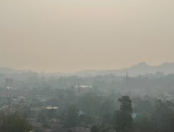
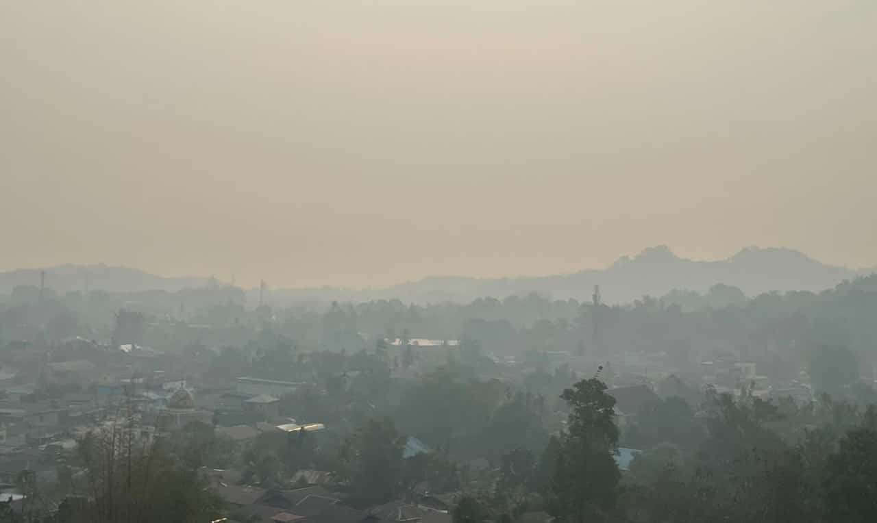
Sorong, Jubi – Smoke haze that has blanketed Sorong City, Southwest Papua, in recent days is suspected to have come not only from fires around the city, but also from fires in South Papua and Teluk Bintuni Regency in West Papua.
Greenpeace Indonesia senior data strategist Sapta Ananda Proklamasi said the organisation’s monitoring had detected 1,634 smoke sources across Papua between August and October 1, 2026.
“The smoke in Sorong is an accumulation of smoke sources stretching from South Papua to Teluk Bintuni in Papua. There were 1,634 smoke sources from August to October 1, 2026,” Sapta said on Saturday (03/10/2026).

Sapta said the haze should not be assessed solely by looking at hotspots. Hotspots are an initial indicator of possible fires, while the impact felt by communities comes from smoke that moves and spreads depending on atmospheric conditions and wind direction.
“These fires have an impact, and that impact is smoke. But the smoke has been overlooked, even though its effects are being strongly felt by communities,” he said.
He said the dry season, combined with El Niño conditions, had made smoke sources easier to detect in satellite imagery because of reduced cloud cover.
South Papua is one of the areas monitored by Greenpeace, Sapta said. The organisation’s monitoring has detected smoke sources almost every day, often in significant numbers.
He said the findings were also reflected in smoke-distribution imagery from Indonesia’s Meteorology, Climatology and Geophysical Agency (BMKG), which showed smoke across several parts of Indonesia, including Southwest Papua, West Papua, Central Papua and South Papua.
According to the data presented, Papua recorded 1,634 smoke sources, including 450 in August, 1,155 in September and 26 up to October 1, 2026.
Across Indonesia, the data recorded 6,811 smoke sources, including 3,628 in Kalimantan, 1,634 in Papua, 1,322 in Sumatra, 152 in Maluku and 75 in Sulawesi.
“The problem is that the smoke sources are not only coming from South Papua. In South Papua, there are many in Merauke, followed by Mappi. Mappi also has a lot. Boven Digoel has fewer because it still has a lot of forest,” he said.
Sapta said the characteristics of each landscape also influenced the intensity and duration of fires.
“In Merauke, there are many swamps and wetlands that have dried out. Especially in the national strategic project areas that have been drained, there is a high concentration of smoke sources. Mappi also has many wetlands. There are quite a lot in the Papua Highlands as well,” he said.
Greenpeace is also monitoring Teluk Bintuni and Fakfak in West Papua, which Sapta said had significant smoke sources that could potentially affect Sorong.
He said fires in these areas could burn for long periods, allowing smoke to be carried by winds over long distances and potentially reach Sorong.
Sapta also highlighted the peatland landscape around Teluk Bintuni, saying fires in peatlands differed from those on mineral soils because the fuel was not limited to vegetation on the surface.
“That is why peat fires behave differently. They last a long time because there is a lot of fuel. On mineral soil, vegetation may burn and then the fire is over. But in peatlands, there is more fuel because it is also underground. So the fire lasts longer,” he said.
Sapta said peatlands and wetlands that had been drained were increasingly vulnerable to fires during the dry season, with El Niño conditions potentially worsening the situation.
Greenpeace monitoring also detected a few smoke sources around or within concession areas. However, Sapta cautioned that the available data was limited and that not every hotspot could be directly linked to a particular concession holder.
He cited preliminary monitoring around oil palm concessions in Teluk Bintuni as one example. Some smoke sources were detected within oil palm concession areas, including areas around Teluk Bintuni associated with Rimbun Sawit Papua (RSP).
“When we checked the data preliminarily, there were also many [smoke sources] around PT Teluk Bintuni Mina Agro Karyana. This is one of the more significant smoke sources, and the smoke can reach the Bird’s Head region,” he said.
Sapta said smoke sources detected in concession areas warranted further investigation because Greenpeace’s monitoring suggested some fires had characteristics associated with land clearing or land preparation.
“These smoke sources tend to be more closely linked to human activity, particularly land clearing and the expansion of companies or corporations. They could involve PBPH, ATI, HPH or oil palm plantations,” he said.
Sapta said the use of fire to clear land was an issue that required serious attention. He said the pattern could continue to recur if it was not addressed, particularly in peatlands and wetlands that had been degraded or drained.
In South Papua, Sapta singled out Merauke Regency for particular attention. The area contains production forests as well as protected and conservation areas.
He questioned who should be held responsible when fires repeatedly occur in protected and conservation areas.
“This is what needs to be investigated: who should be responsible for these areas? It should be the state. The government should deal with it. Fires often occur in protected and conservation areas,” Sapta said.
Sapta also highlighted production forest areas in Merauke that have been allocated for National Strategic Projects (PSN), particularly food and energy projects in the Wanam area.
He said Greenpeace had detected 294 smoke sources in the area as of October 1, 2026.
Sapta linked the smoke sources to areas he described as having been allocated or designated for food and energy projects through the use or borrowing of forest areas.
He questioned who should be held responsible if fires occurred in areas that had been allocated or licensed for specific activities.
“Who should be responsible? The permit issuer, the operator and whoever was given the permit. They should be held accountable,” he said.
According to Sapta, fires in the area were not a phenomenon that had emerged only in recent days. He said satellite monitoring patterns pointed to possible land clearing using fire.
Sapta also highlighted sugarcane concession areas near the Merauke border, where he said several concessions had been detected with fire hotspots.
“The satellites clearly detected it. They burned the trees. The trees were gathered along the road and then burned. That is a very cheap way of clearing land,” he said.
Sapta said the smoke haze in Sorong should prompt further investigation into the sources of the fires, the status of affected areas, the activities taking place there and which parties have authority over those areas. (*)