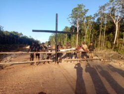

Sorong, Jubi – The Indigenous Knasaimos community in South Sorong Regency, Southwest Papua Province, has completed a participatory mapping of its customary territory, marking a significant step toward strengthening the protection of its ancestral lands and natural resources.
The mapping, carried out between 10 June and 31 July 2026, involved three clans—Onimimnya, Kolin, and Yajan—and was led by the Knasaimos Indigenous Community Council (DPMA) and the Knasaimos Indigenous Youth (AMAK), with technical assistance from the Papua-based non-governmental organisation Bentara Papua.
The participatory mapping initiative aims to safeguard the community’s customary rights over ancestral forests, rivers, coastal areas, and marine territories that have been passed down through generations.

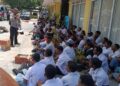
The process placed Indigenous community members at the centre of determining customary boundaries based on oral history, genealogy, and traditional agreements inherited from their ancestors.
The Knasaimos customary territory covers approximately 97,441 hectares and is home to six sub-ethnic groups and 52 clans spread across Seremuk and Saifi districts in South Sorong Regency.
DPMA Knasaimos chair Fredrik Sagisolo said the initiative was more than simply producing a map; it was a strategic effort to protect the community’s existence amid increasing pressure on its ancestral lands.
“We undertook this mapping so that Indigenous communities fully understand the boundaries of their own customary territory. Every boundary point has been mapped using digital applications, providing us with clear and reliable data,” Sagisolo said on Friday, 1 August 2026.
He said the completed map would serve as an important safeguard for Indigenous communities in defending their constitutional rights if future investment projects, development programmes, or other parties sought to use or control their customary lands without their consent.
According to Sagisolo, protecting customary territory is inseparable from protecting Indigenous identity itself.
“If the forest disappears, our identity disappears with it. If the sea is polluted, the lives of Indigenous people are placed at risk,” he said.
“Through this mapping, we want to demonstrate that every piece of land has its own history, recognised customary owners, and traditional laws that must be respected. We will continue to fight for legal recognition of the Knasaimos customary territory.”
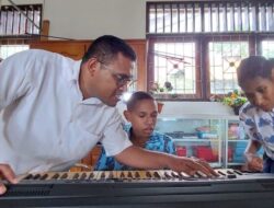
AMAK chair Nabot Sreklefat said involving young Indigenous people in the mapping process was essential to ensuring traditional knowledge is not lost between generations.
He said younger generations must understand the boundaries of their own clan territories so that future generations inherit not only stories but also knowledge of the location of their ancestral lands.
“Through this process, we have learned firsthand about the history of our villages and clans, our customary boundaries, and the relationship between our people and the forests and seas that have sustained us for generations,” Sreklefat said.
He added that the mapping also serves as an educational tool, helping young Indigenous people understand that customary land is not merely an economic asset but a vital part of their cultural identity and ancestral heritage.
“As the younger generation, we must stand at the forefront of protecting our customary lands. We do not want our children and grandchildren to lose their ancestral territory simply because we failed to preserve knowledge of the boundaries handed down by our ancestors,” he said.
Bentara Papua representative Alin said participatory mapping places Indigenous communities at the centre of the process as the primary holders of knowledge, with all decisions based on customary consensus and field verification.
He said Bentara Papua’s role was limited to providing technical assistance, while information on territorial boundaries came directly from community members, who possess detailed knowledge of their villages, clan histories, rivers, mountains, swamps, coastlines, and customary boundaries recognised over generations.
“All of this information is translated into maps with precise geographic coordinates, which can serve as supporting documentation in the process of securing legal recognition of customary territories,” Alin said.
He expressed hope that the completed map would provide an important foundation for the government to formally recognise the Knasaimos customary territory, giving the community greater legal certainty over its ancestral lands.
With comprehensive spatial data now available, he said, the government would have a stronger basis for designating the area as customary forest under Indonesian law.
The mapped territory encompasses forests, rivers, swamps, coastal areas, and marine ecosystems that have long served as the community’s source of food, cultural space, and livelihood.
South Sorong Regency already has a regional regulation recognising and protecting Indigenous customary law communities, providing a legal framework for recognising Indigenous peoples and their customary land rights.
The Knasaimos customary territory has now been formally proposed to Indonesia’s Ministry of Forestry for recognition as a customary forest. (*)